Mannar district is located in the north west of Sri Lanka in the Northern Province. It has an area of 1,996 square kilometres . Aruvi Aru is the second longest river in Sri Lanka and runs through Mannar and Anuradhapura districts. Mannar has artesian springs and aquifers. These water supply comes from Sri Lanka's central areas. The Northern Province has a supply of fresh water from aquifers and it was used in successful cultivation. It only exists in the areas where Red Yellow Latosol exists. These types of aquifers do not exist where Reddish Brown Earth is found. The rest of the Vanni area is void of perennial supply of fresh water.
Adam’s bridge
In the west flank of the peninsular, close to Thalaimanar, lies a string of peculiar sand mounds that link in a chain to Danuskoti, India. According to legend, this where, in the famous epic Ramayana, the king Rama marched his army to free Sita from bandit Rawana. Piercing the vast Indian Ocean like pointed dagger, it is phenomenal natural creation. The strip is home numerous sea urchins, water birds and people alike. It’s a place to unwind and capture the splendour of mother-nature.
The Giants Tank
Sri Lanka’s most ancient tank (lake), that is not mentioned in the chronicles. The shear length of the embankment is five miles alone. It was built before the 12th century and is a stunning point to witness the sun-set and bird life. The tank precincts have now a declared a sanctuary.
Tirikosweram Temple
There has been an ancient landing point connected to the pearl fishery of Marrichkuddi near the great temple, according to historical details. The sprawling temple complex is highly venerated (Isuram’s of Siva) by the Hindus as well as other faiths. The gigantic veil cart’s (elaborately decorated wooden carriages that parade the streets during the festive times) are a great feature here.
The Doric and the port of Arrippu
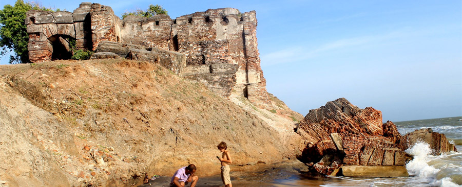
A curios building perched on the beach cliff is the residence of Governor Lord Gulidford built to inspect the flourishing pearl fishery of Marrichkudi. The “Doric” stands for its unique architecture. The shell littered beach bears testimony to the quest of pearls where man and beast succumb in numbers. The Dutch had a fort here and the conditions were so inhospitable that they finally had to abandon it. The fugitive Robert Knox set sail to India from here after 19 years of captivity in the Kingdom of Kandy. Today the pearls are exhausted and what remains is the cries and the echoes of gallant men who tried their fortune in a savagely beautiful land.
Mannar Island Lighthouses
Situated at the end of Talaimannar Road is the Talaimannar pier. The ancient light house there is a construction done by the British in 1915. It is a white concrete round cylindrical tower with a height of 17 metres. Every five second, a light which has the luminous range of 10 NM flashes as a beacon to vessels out at sea. The lighthouse is not used at present even though it is in working condition.
The Talaimannar Pier is situated next to the lighthouse. Part of the pier had been destroyed during the conflict. The pier projects from the mainland and supports a double railway track. In 1964, the pier was damaged by a cyclone. After three years, this was repaired and the ferry service operated until 1983.
